Advancements in agriculture have led to the use of technology in all aspects of the craft. With the demand for food, textiles, and other crops increasing year after year due to population growth, farm operations must find creative ways to increase their production output as well. To do this efficiently, we farmers have to utilize Information and Communications Technologies (ICT), a necessary step to lower our overhead costs while maintaining consistent quality. By adopting and integrating these smart-farming technologies into our daily cultivation operations, we can improve data-reporting accuracy and avoid some of the additional labor requirements, saving ourselves valuable time and capital in the process.
Through the use of sophisticated weather mapping devices, we can identify microclimates around our property and obtain reliable weather forecasts. As cannabis farmers, microclimates play a significant role in choosing the correct cultivars and helps us determine how to prepare for possible upcoming challenges. From our experience, anticipating different phenotypic expressions due to slight variances in climate throughout the garden is essential to success. While many plants of the same cultivar may share the same genotype, the minor differences in their environment - such as a cooler spot in the field, extended sun exposure, or higher-humidity zones - can influence how the plant expresses itself. Because of this, adept farmers work to map out a cultivation site with the intention of having a more homogenized climate throughout the garden. This is especially important for crops such as cannabis where batches of a single strain should look consistent to be desirable.
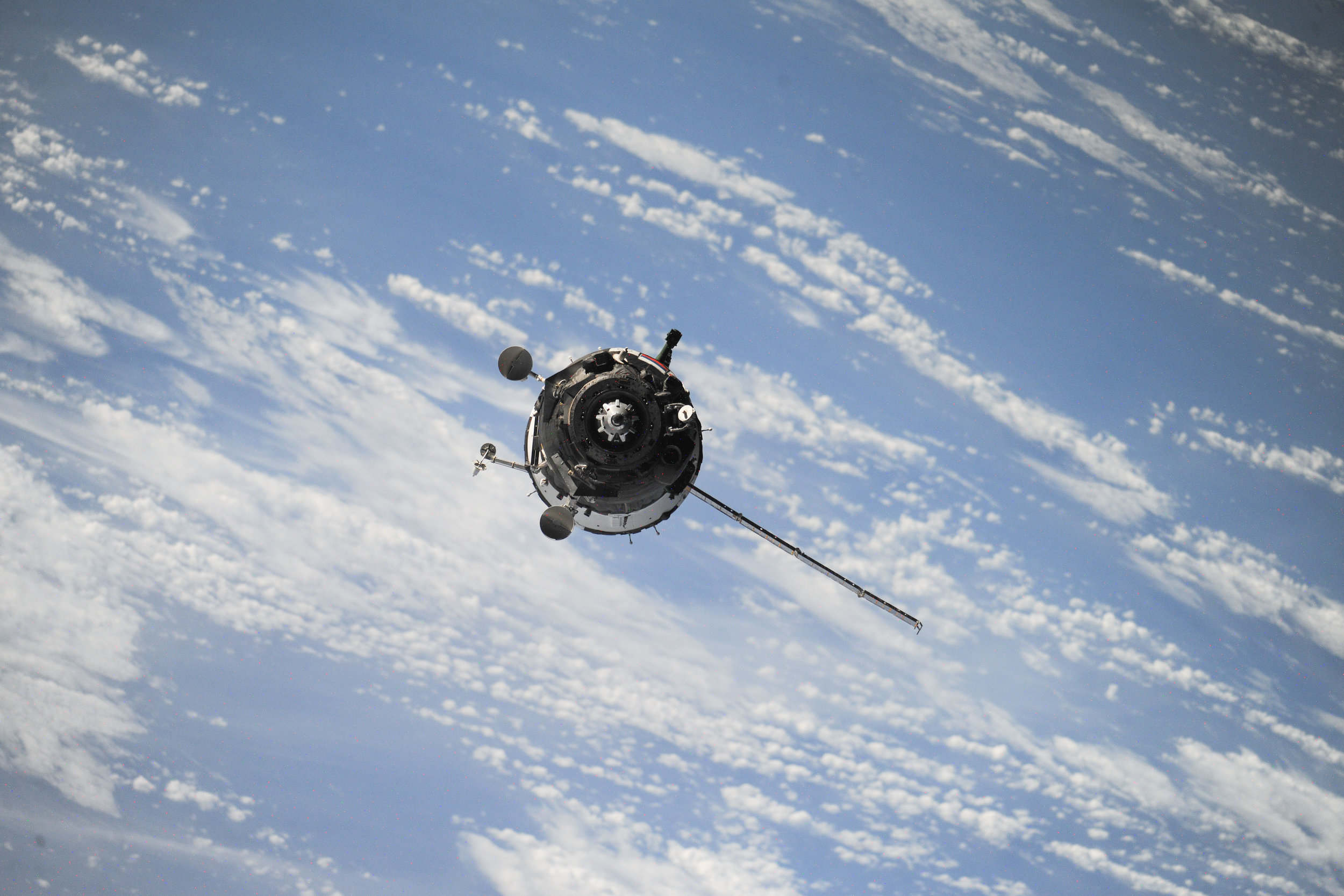
With the advancements in satellite technology, the agriculture sector is no longer hindered by low-resolution areal photography. There are now dozens of companies producing and operating fleets of tiny nanosatellites called "CubeSats" that present ground imagery with unprecedented detail. These shoebox-sized satellites aid us in creating a vivid picture of our farm that we can use to evaluate how efficient our methods are, then use that data to improve our operations. These tools aid us in compliance implementation as well, allowing us to create accurate site maps and find solutions to any potential compliance hurdles.
NASA's Wide Dynamic Range Vegetation Index (WDRVI) is another satellite tool that modern farmers can use to boost their farm's efficiency. This technology is able to distinguish between many different plant species and convey their health status on a localized scale. This information can help us cultivators identify nutrient deficiencies, drainage issues, or pest problems in all areas where our crops are grown, not only where it is easily visible. It saves us time, resources, and labor costs to not have to put our hands on every plant each day and, instead, replace some of the hands-on work with assistance from technology.
The use of satellite imagery in precision agriculture can be coupled with the use of drones to create a detailed picture of a cultivation operation. In the beginning stages, farmers can use drones to map out plantings, create "cell" sections for accurate soil analysis sampling, and organize a cultivation timeline. After the plants are in the soil, drones can monitor the ground temperature, creating thermal maps to identify microclimates within the field or direct a cultivator to areas of the property that may need improvement. These drones can also be used to assess the soil's water content, helping to lower overall water usage and shrink a farm’s ecological footprint. The findings can shed light on issues within an irrigation system and reduce the amount of time it takes to pinpoint where the problem lies. Additionally, drones can help identify pest outbreaks so that cultivators remain proactive in their IPM regimens. Toward the end of a cultivation cycle, drones can be deployed to tally the number of plants and estimate total yields. This data can give marketing and sales teams a headstart and help operators accurately staff harvest and processing teams.
All agriculture sectors are starting to explore the use of smart-farming technologies in their daily operations, including cannabis and hemp farmers. For a crop like cannabis, production is expensive when we take into account the various licenses, surveys, and taxes that not all other crop farmers have to consider. While we personally hold ourselves to a high standard and would regardless of the rules and regulations in place, these technologies have helped us and other cannabis farmers become more successful, profitable, and sustainable.
To learn more about our cultivation process here at Giving Tree Farms, visit our "About Us" page. If you are a licensed distributor, brand, or processor looking for high-quality cannabis, you can fill out a Wholesale Account Form, and we'll reach out to you with purchasing details shortly!